The Queen's Walk
Gressoney-Saint-Jean
-
Difficulties:T - Tourist
-
Best period:
June - September
-
Departure:Castel Savoia (1441 m)
-
Arrival:Tschemenoal (1421 m)
-
Difference in level:132 m
-
length:3.320 m
-
Ascent:1h00
-
Duration coming back:1h00
-
Trail sign:15
-
GPS tracks:
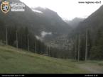
This easy and convenient route is called the “Queen’s Walk” because it is the path that Queen Margherita of Savoy used to take when she left her summer residence in Castel Savoia.
Description of the route
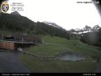
The first section of the path takes you to Lake Gover which is a short distance from the historic centre of Gressoney-Saint-Jean. If on the other hand you follow the path marked no. 15 you come to Tschemenoal which is about two km beyond Gressoney-Saint-Jean.
Accessible to disabled people in wheelchairs if accompanied.


