La Puscerà circular itinerary
Pré-Saint-Didier
-
Best period:
June - October
-
Departure:Verrand (1239 m)
-
Arrival:Verrand (1239 m)
-
Difference in level:227 m
-
length:3685 m
-
Ascent:1h26
-
Trail sign:41-40-40A-41A
-
GPS tracks:
Description of the route
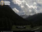
The itinerary starts from the characteristic hamlet of Verrand. Following the indication for the ancient mill, you go up first on the asphalted road and then on the path. Reached the first trail marker, turn right and climb gently up to the panoramic point “Belvedere” where you can find an ancient table with bench in stone. Here, you can enjoy a splendid view of Mont Blanc and Verrand.
Continuing halfway up the hill, you cross an ancient slate quarry and from here the path begins to go down gently first and then with more slope in the woods, arriving at the soccer field of the Courmaison residential complex. After crossing the asphalted road you go up towards Verrand.
Once reached the votive chapel “Chapelle Grange”, continue along the road, not busy, which arrives at the playground of Verrand, where the itinerary ends.


