Loop hike “Queen Margherita”
Gressoney-Saint-Jean
-
Difficulties:T - Tourist
-
Best period:
April - October
-
Departure:Monte Rosa Weg – Obre Platz (1386 m)
-
Arrival:Monte Rosa Weg – Obre Platz (1386 m)
-
Difference in level:105 m
-
length:4 140 m
-
Ascent:1h25
-
Trail sign:105-15-14
-
GPS tracks:
Easy and tourist itinerary, rich of beautiful landscapes and cultural elements. This path ideally connects, through a pleasant walk, the places loved and frequented by Margherita of Savoy, the first queen of Italy, who chose this valley for her summer holidays, from 1889 until 1925.
Description of the route
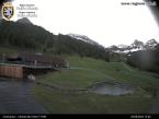
From the car park in front of the Tourist Office, take route Monterosa Weg, opposite the bridge of the regional road on the corner of the cemetery. From there, reach the charming Obre Platz, where you can visit the beautiful and imposing Parish Church dedicated to St. John the Baptist, and Umberto I squares, which represent the heart of the small historical centre of Gressoney-Saint-Jean. Going back on the route Monterosa Weg, go straight on and then take the first small road on the left that allows you to easily reach the romantic Gover lake, surrounded by fir trees and offering a wonderful view of the Monte Rosa massif and its glaciers. Cross the small wooden bridge on the lake and take the path first on the right and then on the left to reach, after a short climb, path no. 15. This itinerary is also called the Queen’s Path, since it leads to the charming and romantic Savoy Castle, the summer residence of Queen Margherita during her stays in Gressoney. The mule track crosses a nice waterfall and ends up at the car park at the entrance to the park of the castle, which can also be visited. From here, continue on the paved road that goes slightly uphill, then take the path that descends under the road at the first bend. In a short time you’ll reach a second fork with a new asphalt road, take this one turning left and follow it until you reach another junction past the small chapel of Greschmatto. Turn right and go straight forward, cross the bridge over the Lys river and cross the regional road to take the path that goes up in the middle of the houses towards the Colle Valdobbia. At the top of the hamlet, before reaching the last house, take the flat path on the left called “dei Lombardi” and follow it, walking near beautiful examples of the local architecture. Cross the stream and follow the track northwards until you reach Villa Margherita, seat of the town hall, and the museum of the alpine fauna “Beck-Peccoz” , whose visit is recommended. Now cross the Lys river again, turn right after the bridge and follow the route until you reach the starting point of the trail.


