

Out & about
Tourist areas

Nature
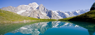
There is a difference in altitude of four thousand metres between the valley bottom and the top of the Matterhorn, which makes for a huge variety of landscapes: from the conifer woods through the green pastures on up to the everlasting snows.
Set against the skyline is the imposing peak of the Matterhorn, 4478 metres of rock that looks down over a spectacular semi-circle of crests, points, glaciers and passes: on the left, the Grandes Murailles chain; to the west, the Becca d'Aver and the Saint-Barthélemy Valley; to the east, the mountain range that begins at the pass at the top of the Cime Bianche and ends at Col di Joux, marking the border with the Ayas Valley.
The Valtournenche is crossed by the Marmore Torrent, which feeds numerous artificial lakes, and has carved out a ravine in the rock, the "Gouffre des Busserailles". Before you enter, you can spot the three potholes formed by glacial erosion. Just beyond here you will see the ravine, 104 metres long and 35 metres deep, carved down into the rock. Particularly spectacular is the waterfall, which leaps down from a height of 10 metres.
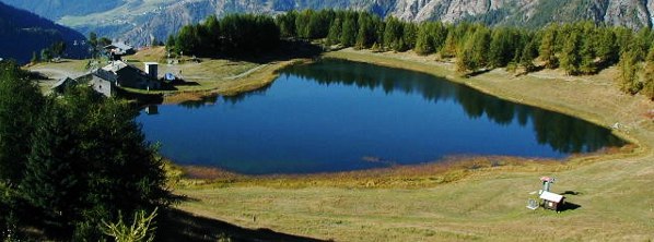
Throughout the Matterhorn area the water has gathered into crystal-clear lakes, such as Lake Lod, on up to the Lakes Superiori delleCime Bianche, and the little Blue Lake, a splendid “topaz” set into the Breuil basin.


