Breuil-Cervinia - Northern Hill of Cime Bianche
Брой-Червинья
-
Уровень трудности:E - Randonnée
-
Лучший период:
Июнь - Сентябрь
-
Пункт отправления:Breuil-Cervinia (2008 m)
-
Пункт пребытия::Upper Hill of Cime Bianche (2985 m)
-
Расписания:977 m
-
длина:6.035 m
-
Durata Andata:3h10
-
Segnavia:16
-
Tracciati GPS:
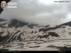
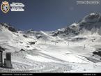
This mountain, known by millions for its ski slopes, has lost none of its charm. Climb up, first over the meadows along the long slope which leads onto Goillet lake, then over the screes where, every summer the miracle of life is renewed with bright flowers and delicate penetrating scent. The Matterhorn and the Grandes Murailles majestically frame the panorama. The hill is also a large space in itself, suspended at a high altitude and closed off by the Cime Bianche as if by a bright stage curtain. Opposite, the lakes lie scaled at the foot of the Rosa glacier, with strong hints of blue that get stronger as the water descends and is purified of glacial silt.
Типичные блюда
When you get to the Plan Maison departure station, continue along the paved road, itinerary 16, which runs alongside it on the right. At the end of the paving, take the left dirt road and continue for a further hundred metres or so, then take the trail on the right, still no. 16, which goes up to Chavanon. Now continue for a short time along the dirt road until you reach a right bend, where you return to the trail on the left. After crossing the road of Goillet, it goes along the usual private road that runs along the banks of the artificial lake. The itinerary then bends right towards the Cime Bianche departure station, from where, as you go up the stony ground, you reach northern hill of the same name.


