Veynes - Roisan along the Ru Pompillard
Saint-Christophe
-
Уровень трудности:E - Randonnée
-
Лучший период:
Январь - Декабрь
-
Пункт отправления:Veynes (805 m)
-
Пункт пребытия::Roisan (779 m)
-
Расписания:16 m
-
длина:7400 m
-
Durata Andata:1h10
-
Segnavia:8
-
Tracciati GPS:
This route follows the final stretch of stage no. 10 of the Cammino Balteo along the Ru Pompillard.
Aosta Valley is particularly rich in “ru”, irrigation canals built between the thirteenth and fifteenth centuries to bring water from the glaciers to the driest areas especially on the southern slopes. Many “ru” are still in operation and can be comfortable flat walks. The hill above Saint-Christophe is even crossed by 3 canals still active and partially covered by paths or dirt roads.
Типичные блюда
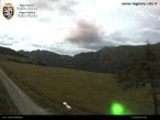
From Saint-Christophe go up the hill to the hamlet of Veynes. The road climbs, makes 3 hairpin bends, crosses Veynes and leaves the country alongside meadows. After about 1 km on the left there is a small parking lot with a pole very clearly visible with yellow signs.
Follow the path n.8. It is a dirt road that runs alongside the Ru Pompillard (completely intubated) and which leads to Roisan with a flat course. After about 3 and a half km there is an unlit tunnel of about 150m with good road surface. Cross it and continue to Roisan. Go back on the same path. Beautiful dirt road to be done also by mountain bike.


