Col di Joux - Testa di Comagna
Brusson
-
Уровень трудности:E - Randonnée
-
Лучший период:
Июнь - Октябрь
-
Пункт отправления:Col de Joux (1635 m)
-
Пункт пребытия::Testa di Comagna (2106 m)
-
Расписания:451 m
-
длина:2.021 m
-
Durata Andata:1h25
-
Segnavia:1B
-
Tracciati GPS:
Типичные блюда
The trail starts at Col de Joux, which can be reached from Brusson or from Saint Vincent, along the road of the same name. Leave the car in the car park and take the road with the “no entry” sign, which goes off into the woods on the left. From here, continue along route 1C until you come to the junction with route 1B, which goes right towards Testa di Comagna.
ITINERARY FOR EXPERT HIKERS: suitable footwear and equipment
ANIMALS you might meet: squirrels, hares, eagles, marmots
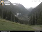
PANORAMA: half an hour from the arrival point, there is a wonderful panoramic viewpoint with benches overlooking Brusson. View over Saint Vincent, Mont Blanc range


