Saint-Jacques - Monte Roisetta
Champoluc /Ayas /Antagnod
-
Difficulties:EE - Expert Excursionists
-
Best period:
July - September
-
Departure:Saint-Jacques (1700 m)
-
Arrival:Mount Roisetta (3288 m)
-
Difference in level:1.563 m
-
length:8.913 m
-
Ascent:4h50
-
Trail sign:4
-
GPS tracks:
Description of the route
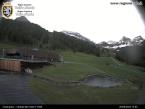
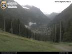
From the square in Saint-Jacques, a hamlet in the municipality of Ayas, follow directions along Alta Via 1 for Grand Tournalin refuge. Once there, take itinerary 4 on the right, and leave the AV1, which continues towards Col Nanaz. The itinerary goes through alpine meadows and stone ground, and provides panoramic views of Cime Bianche, the valley of Nanaz, and the Mount Rosa range.
Tourist excursion itinerary as far as the Grand Tournalin refuge, then recommended for expert hikers only from Grand Tournalin refuge to the summit.


